Project Summary
For several years now, 40th Ward neighbors have voiced concerns about the dangerous traffic conditions on Granville Avenue, which hosts several elementary schools and parks, as well as being a dense residential neighborhood. Granville ranks in the top 10% of residential streets in Chicago for traffic crashes. Our office is partnering with the Chicago Department of Transportation’s (CDOT) Complete Streets team, along with the 48th and 50th Wards, to address these issues and improve pedestrian safety on Granville Avenue.
Project Overview
- Neighborhood: West Ridge, Andersonville
- Zip Code: 60660, 60659
- Scope and boundaries: Granville Avenue from Sheridan to Western
- Timeline: Summer 2025
- Project Website
Status: Upcoming
Quick Links
Scope & Design
Granville Traffic Safety
This project is the product of the community’s concerns around traffic safety along Granville Avenue. In studying the corridor, CDOT identified the following concerns:
- High traffic volumes: Traffic volume on Granville is 2-3 times than that of a typical residential street.
- Dangerously high speeds: Top speeds of over 50 MPH have been recorded throughout the Granville corridor.
- Traffic crash hot spot: Granville Avenue is in the top 10% of traffic crashes on residential streets in the entire city of Chicago, with many blocks located within our ward ranking in the top 5% or even 1% of traffic crashes.
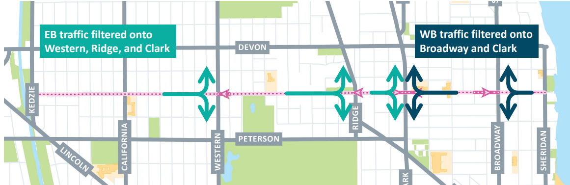
CDOT presented a proposal in October 2024 to increase traffic safety along this corridor by converting several blocks at key intersections to one-ways, and adding additional traffic calming throughout the corridor.
Project Goals
- Reduce non-local vehicle trips on Granville.
- Encourage slower & predictable speeds for the safety of everyone.
- Better organize Granville to accommodate all uses.
- Enhance accessibility to support all the ways people travel on Granville.
Design Exhibits
Project Features
- Traffic calming / pedestrian safety elements at 7 intersections
- Short one-way conversions to discourage non-local traffic
- New speed humps on 11 blocks
- Refreshed crosswalk markings
- Replace missing corner clearance signage
- Bike route pavement markings and signage
Timeline & Construction Updates
Project Timeline
- Bidding: Spring 2025
- Construction: Summer 2025
- Estimated Completion: Fall 2025
Construction Updates
Project updates will be added as they become available.
Engagement
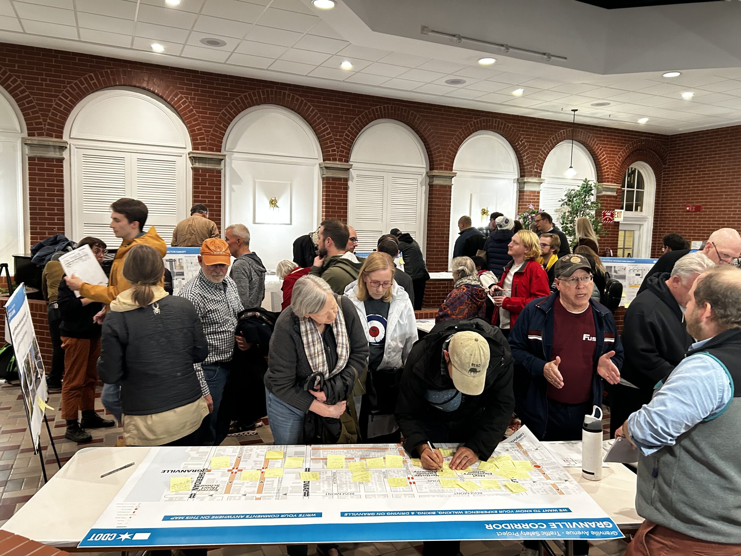
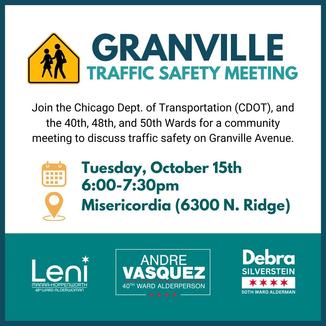
Community Meetings
Public Engagement
- The public engagement period has closed! Please subscribe to updates to be notified of any future engagement opportunities.
Archived Meetings
- The 2025 Development Town Hall included updates on this project. View a summary and recording here!
- Community Meeting at Misercordia on October 15th, 2024; view on YouTube
- A follow up community meeting was held on February 11th, 2025; view recording
Subscribe to Updates
From the blog